Tramline and stops
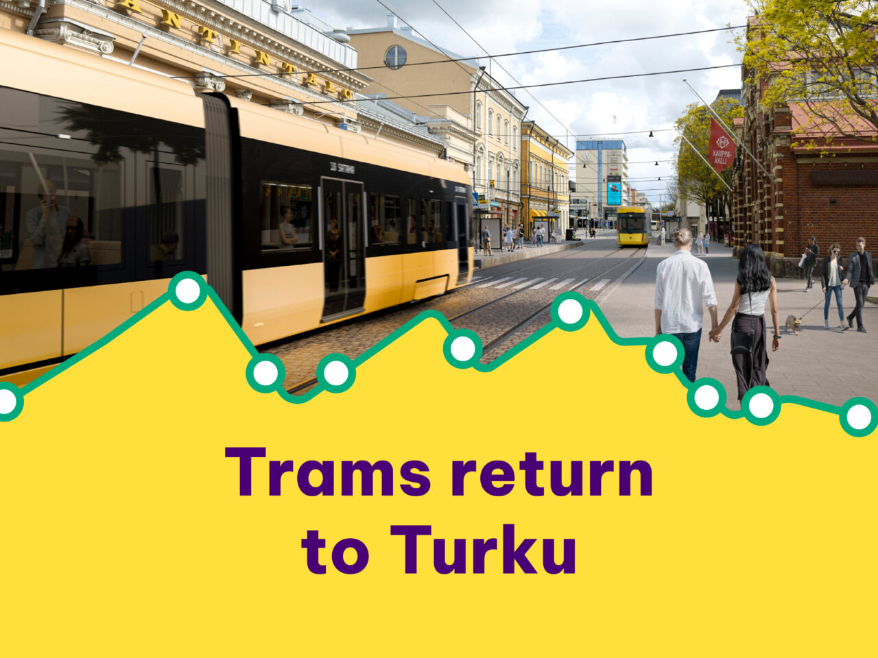
We are building a tramway from Linnakaupunki via the city centre and Kupittaa to Varissuo. The route connects growing areas and major development sites.

The tramway route connects growing areas and major development sites, such as Linnakaupunki, the city centre and the Science Park.
Homes, workplaces, schools and other educational institutions, leisure and sports facilities along with plenty of new services can be found along the tram route. The route also runs past the ferry terminal and train stations, through which thousands of passengers pass daily.
At the moment, about one in four Turku residents live along the route.
Tramline in a nutshell
- Length 12 km
- Length of the connecting track to the depot 1.1 km
- 20 tramway stops
- 14 trams
- Interval 7.5min
- 13 min. from Kauppatori to the ferry terminal
- 10 min. from Kauppatori to Kupittaa
- 14 min. From Kupittaa to Varissuo
Tramline on map
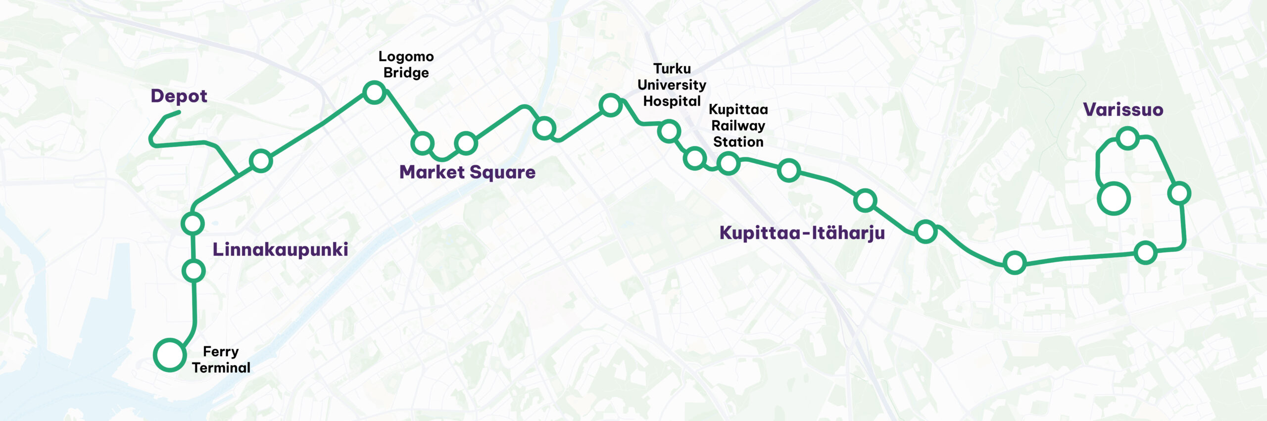
You can also find out more about the route and stops of the Turku tramway in the Turku map service.
The route as a Google Earth video
In the video below, you can get to know the route of the Turku tramway in Google Earth. The video is embedded on the page. If it does not appear, it may be due to cookies. The video can also be found on the Turku tramway‘s YouTube channel.
Tramline sections
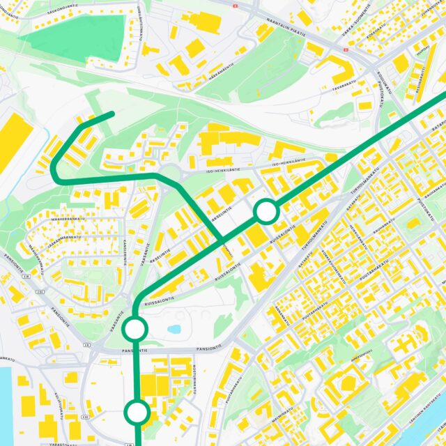
The western terminus of the tramway is in the Port of Turku. The route runs along the Satamakatu and Juhana Herttuan Puistokatu to the Kolmen Katariinan Bulevardi, where there is a public transport lane reserved for trams and buses. The route continues across Tukholmankatu towards Vaasanpuisto. The route has pavements and cycle paths on both sides of the streets from the port to Vaasanpuisto.
From Vaasanpuisto, the route turns towards the city centre and continues along a section for trams, cyclists and walkers only, through Kirstinpuisto to the old central railway station.
Stops on this section of the route are planned at the Port of Turku, Herttuankulma, Vaasanpuisto and Kirstinpuisto.
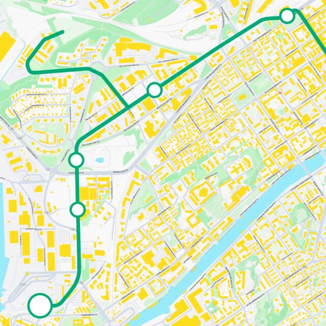
The route will continue from the old central railway station across Ratapihankatu to Humalistonkatu, where the tramway will run on the carriageway together with car and bus traffic until it reaches Puutarhakatu. The section of the street between Puutarhakatu and Eerikinkatu will be reserved for public transport. Humalistonkatu will have sidewalks and a bicycle lane on both sides of the street.
From Humalistonkatu, the route turns to Eerikinkatu, where the tram and buses mainly run in the public transport lane. On Eerikinkatu there is one lane for cars in both directions between Humalistonkatu and Kristiinankatu. There is a sidewalk on both sides from Humalistonkatu to Market Square. Around the Market Square, traffic is only allowed for trams and buses.
Stops on this section of the route are planned at the old central railway station, Humalistonkatu and Market Square.
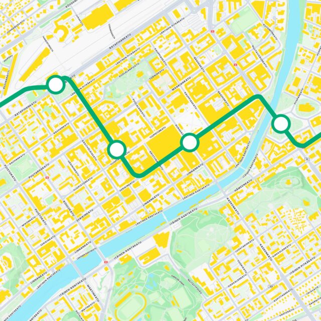
From Market Square, the route mainly follows a public transport lane from Market Square to Aninkaistenkatu. The sidewalks are on both sides of the street. On Eerikinkatu there are cycle lanes on both sides from the junction with Brahenkatu to the junction with Aninkaistenkatu.
From Eerikinkatu, the route turns to Aninkaistenkatu and continues to the Uudenmaankatu public transport lane, where the tramway runs between Tuomiokirkontori and Vanhan Suurtori. Cycle paths and pavements areon both sides of Aninkaistenkatu and Uudenmaankatu.
From Uudenmaankatu the route turns into the Hämeenkatu public transport lane. Cycle paths and pavements run through Hämeenkatu on both sides.
From Hämeenkatu, the tramway turns to Kiinamyllynkatu and proceeds past the Turku University Hospital to Joukahaisenkatu and across Tykistökatu. Kiinamyllynkatu at the Turku University Hospital is reserved for trams, pedestrians and bicycles only. Bike lanes and sidewalks are on both sides of the streets from Hämeenkatu to Tykistökatu.
Stops are planned for this section of the route at Tuomiokirkko, Hämeenkatu and Joukahaisenkatu at Turku University Hospital.
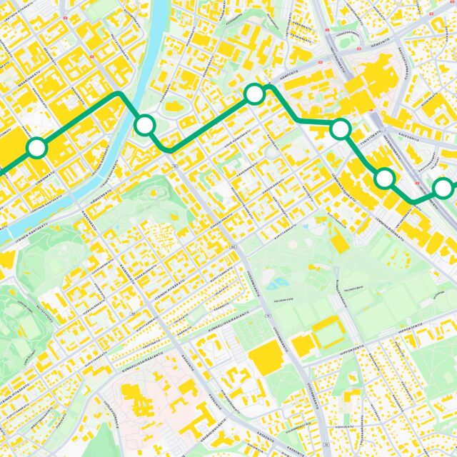
The route continues from Kupittaa along Joukahaisenkatu through the Kupittaa campus area and to the Science Park deck connecting Kupittaa and Itäharju. After crossing the motorway and railway line, the route follows the public transport lane in Itäharju, across Karjakatu and along Voimakatu.
After passing the shopping centre and crossing Jaanintie, the route proceeds to Laukkavuorenpuisto. Cycle paths and pavements are on both sides of the route from Kupittaa to Karjakatu. From Karjakatu to Jaanintie, the route is reserved for the tramway only.
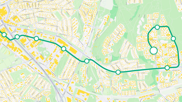
In Laukkavuorenpuisto, the route crosses Jaaninoja and enters Littoistentie, where it initially follows the southern edge of the road to Hurttivuori and then the northern edge of the road to the bottom of the Varissuo business centre. On Littoistentie, cycle paths and pavements are on both sides of the road.
After passing under the Varissuo business centre, the route turns to Karvataskunkatu and proceeds along Suurpäänkatu to Kraatarinkatu, where the eastern terminus of the tramway is located. In Varissuo, the cycle path runs on one side and the pavements on both sides of the street.
Stops on this section of the route are planned for the Joukahaisenkatu campus area, the Science Park deck, Karjakatu, Voimakatu, Laukkavuorenpuisto, Hurttivuori, Varissuo Business Centre and In Varissuo, at Pelttarinkatu, Annikanpolu and Kraatarinkatu.
The connecting track to the depot starts from Kirstinpuisto along Kirstinpolku towards the roundabout in Iso-Heikkilä, then it heads along Revontulenkatuja to Kiertotähdentie. The section between Kirstinpolku and the roundabout is reserved for tram, pedestrian and cycling use only.
The depot will be located at the end of Kiertotähdentien, which is partly a current railway area. The site was previously a snow dump.
The length of the connecting track of the depot is 1.1 km.